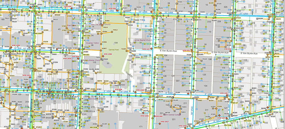
Water Geometric Network
Understanding the needs of Geometric Network Modeling for water distribution, it is important to work on water distribution data along with the district plan (Master Plan) of the water distribution system, lakes, Tanks, forecasting demand based on the demography.
CartoSolution has adequate experience in GIS & BIM services solutions, Delivring data to clients across a wide range of sectors. CartoSolution provide industry standard quality involving latest tech and tools to design and develop in a discreet manner with all quality control.
GIS FOR Water Utilities
- Map design for network editing
- Focused Geometric Network editing
- Tracing and reporting
- Data construction
- Automated attribute genration
Prerequisite
- GIS Data – Complete water network, Base map.
- Census Details
- Pumps Detail
- Water tanks in the area
- Survey Data
- Ground Varification
Web GIS for Water Network
Web GIS/Cloud is requirement of this highly connected society which enable each of us to contribute in planning, managing and maintenance of infrastructure and make optimum use of limited water resources. Web GIS dramatically cut the budget of maintaining and reporting of infra this is an efficient and smart use of spatial database. Location, job tracking, operations planned using Web GIS will let you to access required resources and collaborating in real time with field crews and office personals.
water, sewer, and stormwater network
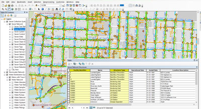
Water Geometric Network Editing and Analysis technique to manage water, sewer, and stormwater network data mapped in a existing geometric network. Our solution takes advantage of pre-existing data and latest tools.